


lac de Sorapiss

med88
User
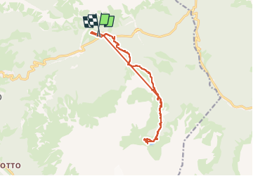

Length
15.2 km

Max alt
2206 m

Uphill gradient
1344 m
Km-Effort
33 km

Min alt
1703 m

Downhill gradient
1340 m
Boucle
Yes
Creation date :
2025-06-25 07:06:41.302
Updated on :
2025-06-25 14:50:46.504
3h16
Difficulty : Difficult

FREE GPS app for hiking
 SityTrail
IGN / Geographical institutes
SityTrail Plus
The world is yours!
About
Trail Walking of 15.2 km to be discovered at Veneto, Belluno, Cortina d'Ampezzo. This trail is proposed by med88.
Positioning
Country:
Italy
Region :
Veneto
Department/Province :
Belluno
Municipality :
Cortina d'Ampezzo
Location:
Unknown
Start:(Dec)
Start:(UTM)
285172 ; 5159679 (33T) N.
Comments